|
|
|||||||||||||||||||||||||||||||||||||||||||||||||||||||||||||||||||||||||||||||||||||||||||||||||||||||||||||||||||||||||||||||||||||||||||||||||||||||||||||||||||||||||||||||||||||||||||||||||||||||||||||||||||||||||||||||||||||||||||||||
NavNet vx2 - Radar
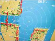
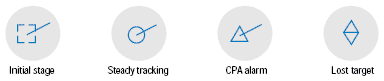
Automatic radar plotting (ARP)
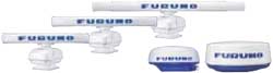
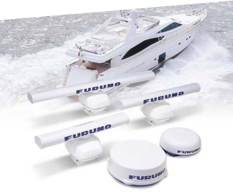
Radar Antennas
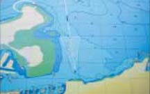
NavNet vx2 - GPS/WAAS Chart Plotter
C-Map NT MAX chart
NavNet vx2 accepts the C-Map’s new NT MAX charts. The NT MAX unique features
include live nav-aids, tidal flows, local street maps, photographs of harbors and
perspective view in addition to grounding alarm (Guardian Technology™).
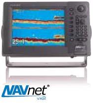
NavNet vx2 - Fish Finder
NavNet vx2 - GPS/WAAS Chart Plotter
|
||||||||||||||||||||||||||||||||||||||||||||||||||||||||||||||||||||||||||||||||||||||||||||||||||||||||||||||||||||||||||||||||||||||||||||||||||||||||||||||||||||||||||||||||||||||||||||||||||||||||||||||||||||||||||||||||||||||||||||||||
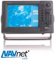
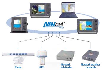 From a stand-alone, single station navigation system to
a multistation integrated navigation network, NavNet vx2 lets you
build your navigation system according to your needs. Utilizing
state-of-the-art network technology, NavNet vx2 provides you with
seamless data sharing and vast future expandability.
From a stand-alone, single station navigation system to
a multistation integrated navigation network, NavNet vx2 lets you
build your navigation system according to your needs. Utilizing
state-of-the-art network technology, NavNet vx2 provides you with
seamless data sharing and vast future expandability.

 MaxSea-NavNet
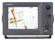
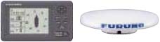
 GPS/WAAS antenna
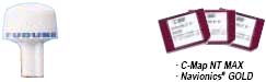
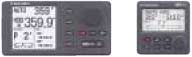

 RD-30
RD-30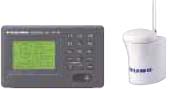 AIS
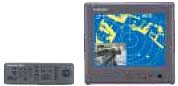
AIS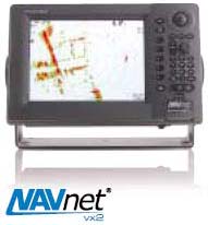 High-performance radar is one of
the main components of NavNet vx2.
Known for our award winning and
reliable radars, the NavNet vx2 radar
includes the following features:
High-performance radar is one of
the main components of NavNet vx2.
Known for our award winning and
reliable radars, the NavNet vx2 radar
includes the following features: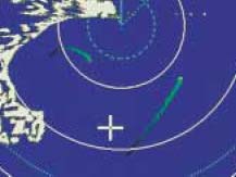
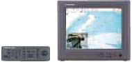
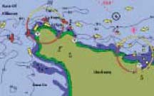
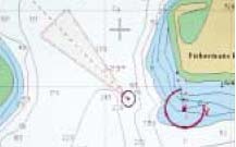
 Working in perfect collaboration with the NavNet vx2 radar is the GPS/WAAS chart
plotter. It shows your exact position and offers a variety of display modes that allow
you to organize your nav data with unparalleled ease.
Working in perfect collaboration with the NavNet vx2 radar is the GPS/WAAS chart
plotter. It shows your exact position and offers a variety of display modes that allow
you to organize your nav data with unparalleled ease.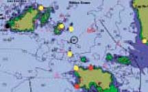
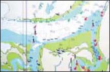
 For years, Commercial Fisherman have relied on FURUNO's fish finding technology
to help them make a living. FURUNO's network fish finders implement the same tried
and true fish finding technology that is used in our commercial-grade fish finders.
Plug a network fish finder into your NavNet vx2 system and it turns any display in
the network into a high-performance fish finder.
For years, Commercial Fisherman have relied on FURUNO's fish finding technology
to help them make a living. FURUNO's network fish finders implement the same tried
and true fish finding technology that is used in our commercial-grade fish finders.
Plug a network fish finder into your NavNet vx2 system and it turns any display in
the network into a high-performance fish finder.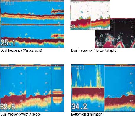
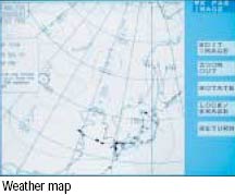
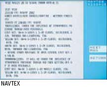
 Network weather facsimile receiver
 |
 |
 |
Interface with AIS NavNet vx2 lets you integrate AIS (Automatic Identification System) into the network with an optional component. Information for up to 100 AIS targets can be displayed on any networked unit. This integration provides you with a solution for observing other vessels. (AIS receiver required)
- Display up to 100 AIS equipped targets information (the information is displayed in the AIS data cell)
- Indicate the state of targets with five symbols

Interface with the
|
 |
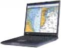
NavNet vx2 - MaxSea-NavNet PC software
Defining the cutting-edge of applied information technology, MaxSea-NavNet software is a powerful navigation tool for boaters who are looking for a user-friendly interface and a more comprehensive navigation system.
MaxSea-NavNet software offers increased efficiency at sea by using its exclusive capabilities, such as seamless chart displays, advanced weather forecast overlay, real-time three dimensional images of the seabed (Personal Bathymetric Generator) and many more. Intuitive operation of MaxSea- NavNet is achieved by its user-friendly interface and graphical tool palette. MaxSea-NavNet presents the ultimate solution to navigational data management.
- Sharing C-Map NT chart data as well as all the navigation
data within the NavNet network
NavNet provides MaxSea-NavNet with radar, fish finder and essential navigation data from various networked sensors. - Full control of NavNet
MaxSea-NavNet offers full control of the NavNet display, such as radar range, gain/STC control, etc., in addition to handling the navigation data to display in a diverse range of formats. - 2D/3D ground discrimination function allows boaters to see the Bottom Roughness, Hardness and Classification overlaid with MaxSea 2D/3D charts*
- 3D chart data conversion with C-Map NT chart*
- ARPA radar target tracking capability*
- AIS transponder compatibility*
* Optional modules that may require additional equipment
 Interface with the NavNet system
The MaxSea-NavNet software is capable of combining and
analyzing data from multiple sources in real-time. Fully
integrated into the NavNet system through a high-speed
Ethernet network, MaxSea-NavNet facilitates the complete
integration between the PC and the NavNet network,
sharing information from the radar, GPS, echo sounder and
other nav data within the NavNet system. A variety of
display orientations can be selected to meet your needs.
MaxSea-NavNet radar overlay
MaxSea-NavNet provides the highest quality electronic charts available as the basis for its radar overlay. MaxSea- NavNet overlays the full radar image at the same scale and creates a dramatic improvement in accuracy and clarity. MaxSea-NavNet radar overlay gives you amazingly detailed images. The range of color and transparency of the overlay guarantees that the chart is not hidden. This allows for the confirmation of precise positioning relative to the chart and clearly reveals any inconsistencies.
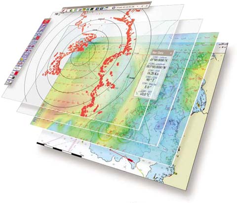 The unique overlay system optimizes data visualization
Using MaxSea-NavNet's multiple “overlay” system, various layers of information can be superimposed on the screen. Each overlay contains different types of data, such as tracks, marks, hazards, wrecks, ports, currents, water temperature, etc. Based on the needs of the moment, a single click can make each layer visible or invisible, eliminating irrelevant information and clearly showing objects of interest.
Optional Personal Bathymetric Generator (PGB) clearly shows the contours of the bottom
Connected to the network sounder and GPS, MaxSea-NavNet PBG records the position and the depth as your boat proceeds, which enables you to create 2D and 3D charts with pinpoint accuracy in realtime. With a single click, MaxSea- NavNet PBG will be activated to give breathtaking real-time 2D and 3D images of the seabed.
SYSTEM REQUIREMENTS
Your PC must meet the following system requirements in order to work with MaxSea- NavNet. Please verify these requirements before installing.
- Windows® 2000 or XP
- 800 MHz processor
- CD-ROM drive – for installing MaxSea-NavNet
- Serial or USB port(s) – for connecting navigation equipment (An adapter must be used for USB connections – see the section on connecting equipment for more information.)
- 700 MB of hard drive space
- Graphic card: 32 MB (64 MB recommended)
- Network facility required
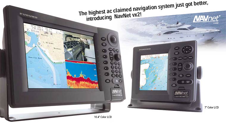
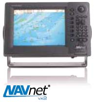
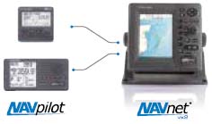
NavNet vx2 - Display Unit
10.4"/7" display unit
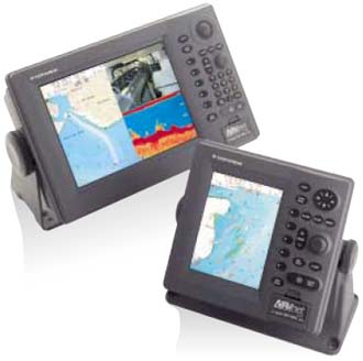 NavNet vx2 provides you with a multi-station option for your
navigational requirements. Two types of display units are
available: 10.4" and 7" high brightness, sunlight viewable
LCD's. Excellent all-round presentation with a wide viewable
angle, VGA screen resolution ensures a superbly detailed
picture.
NavNet vx2 provides you with a multi-station option for your
navigational requirements. Two types of display units are
available: 10.4" and 7" high brightness, sunlight viewable
LCD's. Excellent all-round presentation with a wide viewable
angle, VGA screen resolution ensures a superbly detailed
picture.
- High-brightness LCD viewable under direct sunlight
- Enhanced visibility with Anti-Reflective (AR) coating to cut down annoying glare
- Common user interface for compatibility among the display units networked
- Easy operation using a trackball* and rotary encoder (*for 10.4" models)
- Multi-station networking of up to four display units
- Simple connection between each sensor and display unit
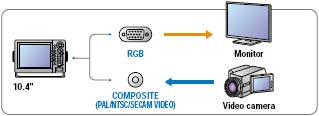
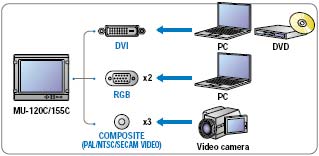
- Analog RGB video output available for remote monitoring (for 10.4" models)
- NTSC/PAL input available for displaying video images from onboard TV/VCR/DVD player (for 10.4" models)
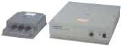
12"/15" LCDs with BlackBox unit
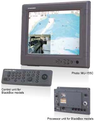 FURUNO MU-120C/155C LCD units can be used as display
units for BlackBox models. When connected to BlackBox
models, the MU-120C/155C offers the same functions as
the 10.4" display unit on top of its exclusive functions.
BlackBox models also can work with commercial monitors.
FURUNO MU-120C/155C LCD units can be used as display
units for BlackBox models. When connected to BlackBox
models, the MU-120C/155C offers the same functions as
the 10.4" display unit on top of its exclusive functions.
BlackBox models also can work with commercial monitors.
- Picture-in-Picture (PIP) function to display a small image window on top of the main display
- Built-in scaler to accept up to SXGA screen resolution*
*With NavNet vx2, the display unit display the images in VGA resolution - Easy channel selection
- Waterproof, low profile unit for flexible installation
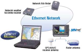
NavNet vx2 - Network Sensors
Whether it is the radar and GPS/WAAS antennas that connect directly to the NavNet vx2 displays or the optional network sensors that connect through the Ethernet network, all of the data obtained from each sensor can be shared by every display on the network. The beauty of NavNet vx2 is that you can start with a single unit and expand its features as needed.
| Radar antenna Each NavNet vx2 radar comes with a commercial-grade FURUNO antenna. The output power of the antenna units ranges from the sleek 2.2 kW radome to the powerful 25 kW open array. |
GPS antenna Simply by plugging the GP-320B GPS/WAAS receiver antenna into any NavNet vx2 display, all the displays networked can show highly accurate position data. |
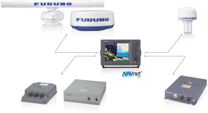
| Network fish finder The network fish finder can be plugged into any display or a Hub to turn the NavNet vx2 display into a high-performance dual-frequency fish finder. ETR-6/10N-BBFF1 Frequency: Dual-frequency 50/200 kHz Output Power: 600 W/1 kW rms Basic Range: 8 range scales to 2,500 ft ETR-30N-BBFF3 Frequency: Dual-frequency selectable from 28/38/50/88/107/200 kHz Output Power: 1/2/3 kW rms Basic Range: 8 range scales to 3,600 ft |
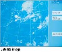
Network weather facsimile The FAX-30 is a network weather facsimile receiver that works with 10.4", BlackBox models or a PC to display weather maps, satellite images, NAVTEX and other navigation information. |
Government Links | News | Products | Service | Surveys / Inspections | Past Projects | What`s new | Links
Download Forms | Job Opportunities | Contact Us | E-mail Addressess | Directions to Office | Request a Quote
Honor Marine Electronics
1804B Cleveland Ave - National City, CA 91950
Phone: (619) 233-7666 Fax: (619) 231-0397